27/02/2023 | Partner: Regione Valle d'Aosta
Travel to Chamonix
Our journey starts from the Saint Martin de Sallanches bridge, an iconic place represented in all its possible perspectives by 19th-century prints, then goes up the course of the Arve river, along the right bank, to reach, after Passy, the wide plain that once, before the Romans, was said to be occupied by the town of Dionysia.
Settlement overwhelmed at one time by the collapse of the banks of Lake Servoz and later filled by a landslide in the town of Chedde, which gave rise to the beautiful waterfall called ‘Cascade du Coeur’, because its waters fall drawing a heart.
From Chedde we climb painstakingly to Chatelard, natural enclosure of the ancient glacial lake that occupied the Servoz plain. First surprise: we come across ancient fortifications raised by the Nantuates, the local population, against the Ceutrones, dating back to the pre-Roman period.
Servoz was and remains a dream: on our right, suddenly, Mont Blanc rises in all its beauty against the backdrop of the remains of Saint Michel castle, while on our left we can see the Gorges du Diosaz, the most impressive gorge in Europe.
The wayfarer who had laboriously come up here – the travel descriptions of Alexandre Dumas and Horace-Benedicte De Saussure are marvellous – was now beginning the most dangerous stretch, which carriages could not face: Montà Pellissier. From here, through a long climb in the harmony and enchantment of a fairytale forest, you cross Vaudagne, reaching Tête Noire. The charm of the legend that wanted the Devil to tempt and kidnap the virgins from a split of the rock, making a room full of gold appear to them, is still intact here. Charm of a legend that is not at all disturbed by the onsite presence of a Roman tombstone from the first century AD identifying the boundaries between the various jurisdictions
The descent to Les Houches, always immersed in the green of the forest and illuminated by the reverberations of the glacier, remains out of time. Les Houches, a name derived from the term ‘olca’ by which the Celts designated the stretch of land cultivated around the house, is certainly the oldest of the valley settlements, given the situation of swamps and morainic residues that once occupied the Chamonix plain.
This route became carriageable only in 1818, but only with the cession to France of the Haute Savoie and by personal intervention of Napoleon III, it assumed the dignity of a true road (1867).
For the record, the time of a carriage trip from Geneva to Chamonix in 1850 was 11 hours for a distance of only 90 km.
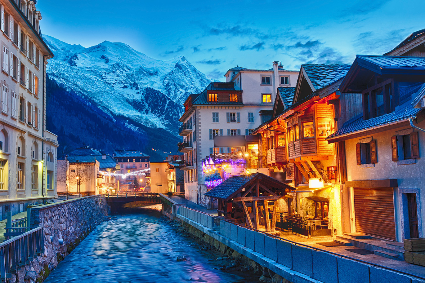
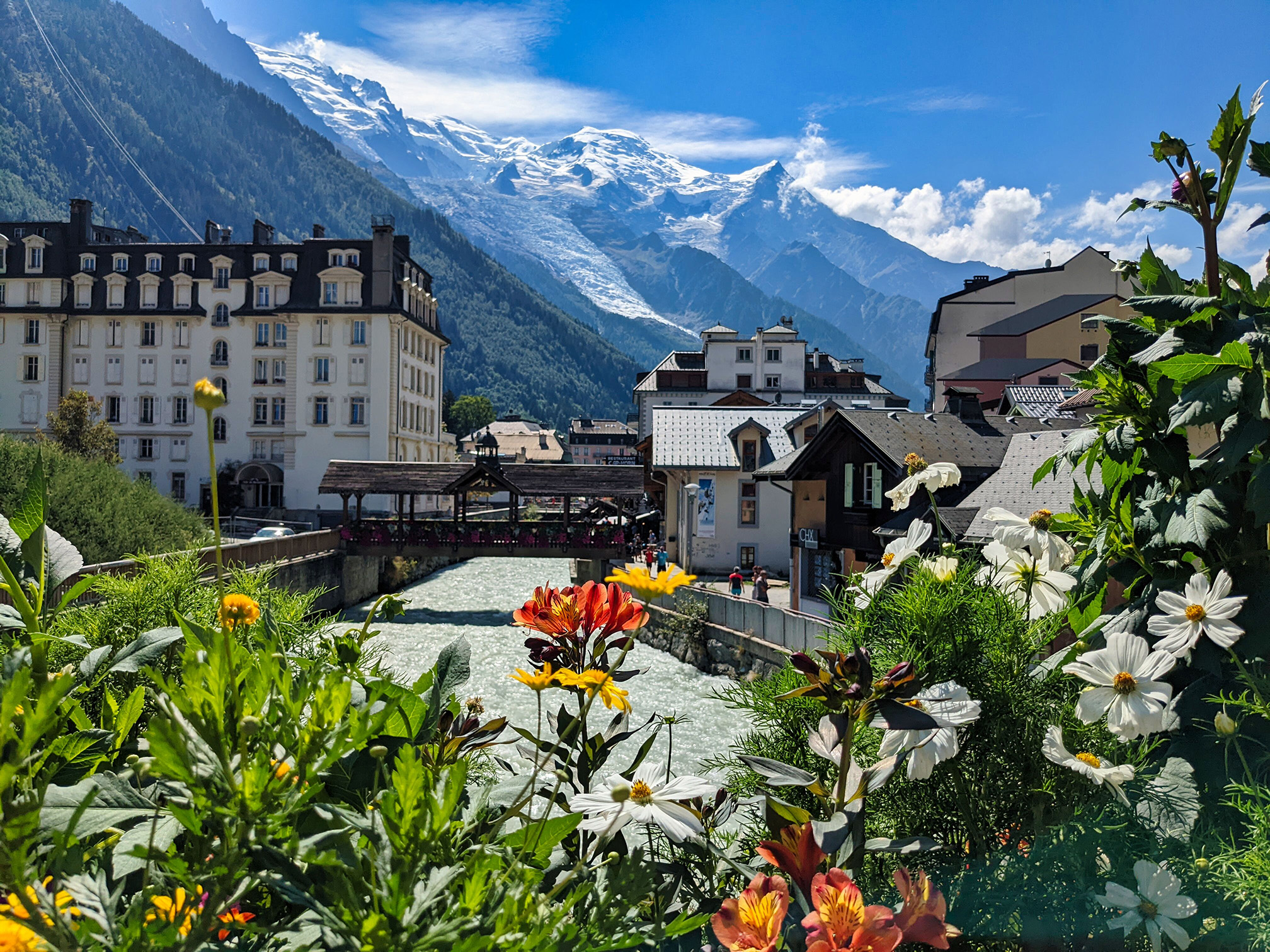
We have thus reached Chamonix, whose probable origin dates back to 1119 if we consider that the foundations of the church, once Benedictine Abbey, date back to that date. But only in 1236 can we trace the current denomination with certainty. Certainly because it results from a document of cession of the territory from the Count of Faucigny to the Benedictine Abbey of Saint Michel de Cluses.
The meaning of the name Chamonix is quite debated, although the most credible seems to be that of ‘fenced field’ or ‘mill field’.
The territory had its own administrative and legal autonomy in the Middle Ages, although the full powers belonged to the Abbey of Sallanches. The construction of the first hotel, Madame Souterraud’s, dates back to 1770, but by 1850 the hotels had grown to nine and Chamonix’s visitors amounted to 5,000 in the summer season alone.
The valley of Chamonix is 20 km long and the first village we meet after Chamonix is Praz, a village characteristically lying along the way. Immediately after, beyond the Arve, lies the beautiful centre of Bois, once fertile and pleasant grassland until the ices of the Mer des Glaces submerged it. Such a terrible tragedy that in the year 1690 the Bishop of Geneva climbed up here to call upon the halt of the ice river in flood, with rituals and prayers. Legend has it that his prayers were heard and that the ice retreated by half a league.
We like to say that the Arveyron stream originated from the glacier – the source in the ice cave is reproduced by numerous prints from the past century – and it is here, in the ‘Prairie’ that the fairies played, unfortunately put to flight by the descent of the ice. They took refuge in the enchanted rocks of Magland (Cluses), abandoning their treasure and their jewelry. That is why golden straws are still found in the waters of the Arveyron stream today.
Now here we are at Les Tines which takes its name from the Latin ‘tina’ = basin.
Once, it is said, there was a small church that was emptied by four iconoclastic thieves who were found frozen, with all their loot, the following days at the Grand Saint Bernard Pass.
Rapid ascent on the sides of a large morainic landslide to reach the magical place that responds to the name of Lavancher, a village rebuilt after a huge avalanche that descended from the Aiguille Vert in 1818.
The next plain, up to Argentière, was until historical times a large lake. Argentière, once on the edge of the glacier, has a beautiful Baroque church from 1726 whose altar, of Spanish inspiration, was painstakingly brought from Italy (where it had been built) through the Grand Saint Bernard Pass and Col de Balme.
Climbing to Col de Montets, integral nature reserve, we enter the Vallorcine, or Ursina Valley, or Vallée des Ours, whose population of German origin, comes from Leuk, in the Valais (XII century).
Here we find the only parish church that has a huge wall around it in defence of the avalanches. Our itinerary ends at the Barrage d’Emosson, 2,000 metres above sea level. This dam is not so much interesting for its size (180 meters high), but for having buried a splendid pasture on whose property a bloody battle was fought in 1323 between the Count of Faucigny and the abbots of Saint Maurice d’Augane, with as many as 120 dead.
Up there, still today, a small chapel, from which the gaze ranges from the Matterhorn to Mont Blanc, recalls the end.
If you want to dream of an even more distant past, climb further to find, above Vieux Lac d’Emosson, the footprints of the dinosaurs imprinted on what were the beaches of the Sea of Thetis.
Among history, stories, and legends, in these mountains the spell truly exists!
Partner: Regione Valle d'Aosta
Sito di riferimento: